Burnside to Bowling (hopefully) and back
Wednesday 12th February 2025 10:00am
Starting from - Outside Hugh’s Restaurant on the junction of Highburgh Drive and A749 Stonelaw Road in Burnside. G73 3SB
This Burnside, Rutherglen & Cambuslang Community Rides ride is open for anyone to join
- 30.8 miles
- Mountain Bike, Hybrid (off road tyres), Hybrid (road tyres), Road, eBike
- 4 hr
- Challenging
- South Lanarkshire
- Adults 16+ only

Organized by groups in the community, these rides are a great way to meet new people, explore your local area and to have fun riding your bike. You can find rides that are suitable for your level of experience and interests whilst enjoying being part of a social cycling community.
Forgot password
Forgot password
Your details
Forgot password
Your details
About the route
Starting point
Lanarkshire
G73 3SB
You can see the route at https://ridewithgps.com/routes/49680728
Please be aware that we aim for an average speed on the move of 10 – 11 mph. This is not the route for you if you are looking for a much faster road ride.
Route rating
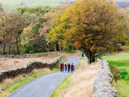
(0) ReviewsI describe this route as a leisure ride. We will not be going too fast but we try to maintain a minimum speed on the move of 10 mph. It aims to avoid roads and makes use of cycle paths as much as possible. It takes us out to Bowling on the Forth and Clyde Canal. This plan takes us back the same way. However, there are a number of return options which are longer if the group wishes to follow one of them instead. Following Storm Éowyn, there were a number of trees blocking the route. I don’t know the current situation, and we may have to change or curtail the route depending on what we find.
Wherever possible, the route follows the National Cycle Network, much of which is shared paths. The route is classified as paved for 99% of its length. There will be some cycling on roads but I have kept them to a minimum.
The ride heads out to the end of the Forth and Clyde Canal where we will stop at the café which has toilets. https://www.facebook.com/p/Patons-Place-100043279343171/ If anyone sees something they'd like to stop and look at, we'll stop.
This is Scotland and as we all know, the weather can be ‘variable’. Please check the forecast before leaving and come prepared. If the weather looks to be really terrible, the ride is likely to be cancelled. Currently, there’s a low chance of rain but the chill factor from an easterly wind means it will feel around 0˚C. Warm clothing is recommended.
First-timers welcome but please check the anticipated cycle speed.
Route elevation
Who else is on this ride?
4 ride participants
-
Rodger McEleney
-
Paul Rimmer
-
Community Groups Volunteer

-
-
Vivien Macleod
-
Hilary Templeton


Conversation
Register to join the conversation about this ride