Riding a Cycle Route before leaving the house: Using the route map
Check a British Cycling route is right for you by using the interactive map. Five minutes of research could save you from a thirty-minute detour on the bike. This article explains how to take a virtual tour using the map tool, so you can step out the house knowing what to expect.
Map layers
You can research your route using either the ‘Map’ or ‘Satellite’ view. Each have their benefits when planning your ride. Switch between the two using the buttons in the top left corner of the map.
Map view:
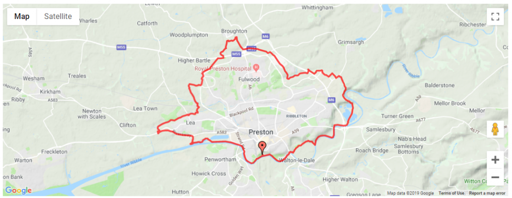
Map view is best used for:
• Understanding place and road names. The level of detail varies by adjusting the zoom.
• Identifying main roads. Any sections of the route that may cut across a busier road can be easily seen. Main roads are labelled and appear thicker on the map. This is useful if you’re planning on traveling to the route via car or if you’re trying to avoid the traffic whilst riding.
Satellite view:
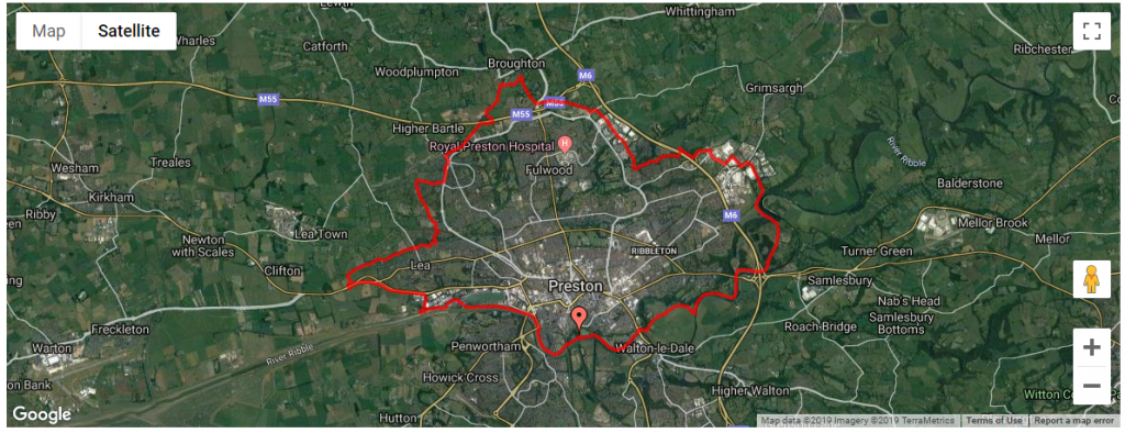
Satellite is best used for:
• Understanding the environment. More detail in general can be seen in satellite view. Information on the type of terrain or amount of tree coverage on a route can be identified. Zoom in far enough to view the area in 3D.
• Identifying where to have a pitstop. The map will show most local services on route, be it a café, bakery or pub. With some follow up research, you’ll know if they’re bike friendly or if they serve your favourite brew.
• Understanding the surrounding geography. Zoom out far enough to see if an area is well built up or relatively rural.
Street view:
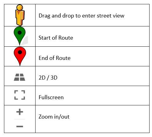
Drag and drop the ‘orange person’ symbol to enter street view, this is where it’s just like being on your bike!
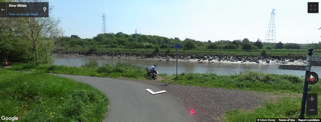
Street view is great for:
• Assessing accessibility. It is easy to understand the width of the path or trail. See if you could ride two-abreast, or whether the path is suitable for adapted cycles.
• Understanding the route surface. See what kind of terrain you’ll be riding on. Use this to judge which bike types are suitable.
• Know where to turn. Buildings and objects make for great reference points, or what we term waymarks, to remember where to turn. For example, ‘left at the train station, then right at the Zebra crossing’. You’ll be able to keep your phone in your pocket, avoiding unnecessary stops to check the map.
Symbol key: